Mountain Bike Rides
SAN BERNARDINO NATIONAL FOREST CLOSURE INFORMATION
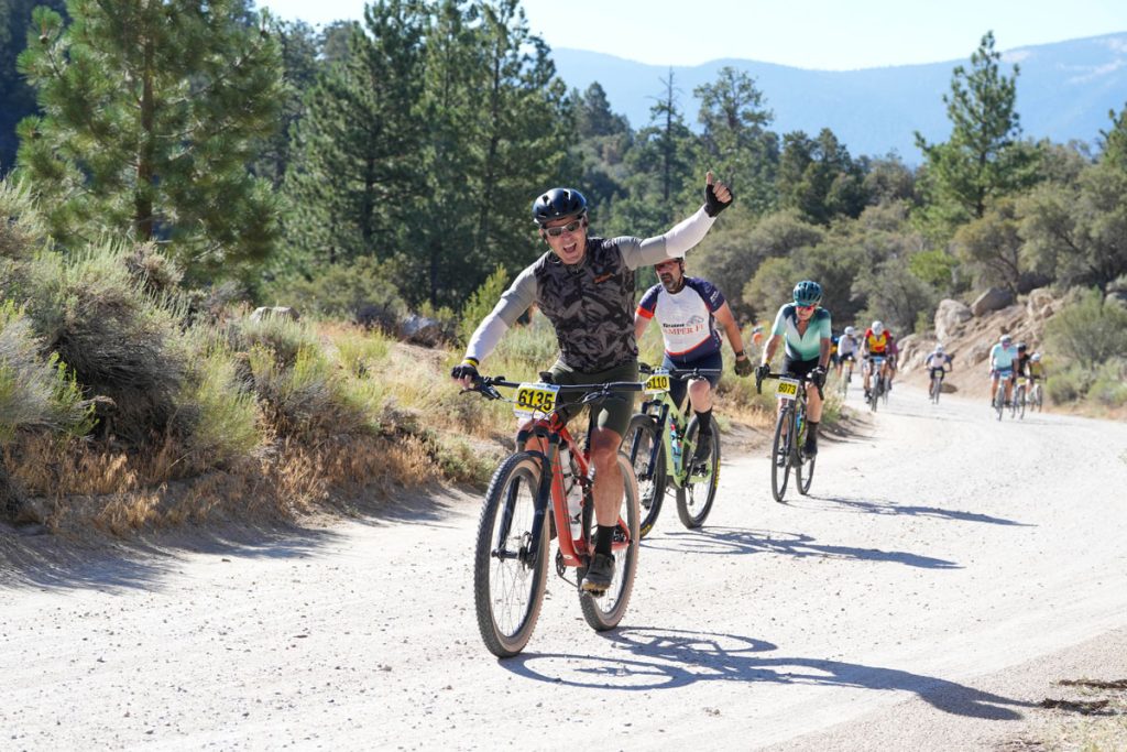
There are many beautiful rides in the Big Bear Valley. Check out MTB Project or some of the recommended routes below or join us on one of our weekly Community Rides!

Where the Locals Ride
Big Bear Mountain Bike Rides
Skyline – The Skyline Trail is a great singletrack trail that traverses the mountains above Big Bear Lake and the Snow Summit Ski Resort. Skyline can be ridden in either direction (East or West). Pick up Skyline from the East side (near Bear Mountain Resort) at 2N10. Limited parking is available there. Climb the 2N10 fire road or the adjacent singletrack trail. Alternatively, park at Aspen Glen on the West side and climb out from there. Skyline offers numerous trail choices; ride the entire trail on the singletrack or mix in some fire road with it. Additional details
Grout Bay/Hanna Flats Loop – (7 to 12 miles, easy/moderate) Hiking and biking trail; singletrack, dirt road, paved road. Dirt road climb to rolling downhill singletrack. Out and back up to Grays Peak and then downhill back to beginning. Additional details
Pine Knot Trail (1E01) – (3.1 miles one way, easy/moderate) Popular and well maintained trail that ends at a great overlook. 100% singletrack. A classic Big Bear trail, Pine Knot takes you from the Aspen Glen picnic area up into the forest. Along the way are great views of Big Bear Lake, a walk along a creek and through a meadow, and it ends at Grandview Point, overlooking San Gorgonio and the Santa Ana River Valley. From here head back down to your original trailhead. Loops / Variations: Head west along 2N10 until you reach Trick or Treat or Plantation Trail. Additional details
Santa Ana River Trail (2E03) (SART) – (Intermediate) Scenic singletrack trail cutting along the sides of steep ridges in the Santa Ana River Valley. An EPIC trail with tons of variations. The Santa Ana River Trail will bring you to large meadows, steep cliff edges, peaceful creeks, and breathtaking vistas through the Santa Ana River Valley. It begins by Heart Bar Campground with sandy rocky single track that is crisscrossed with many other trails and then travels through an arid forest and along and above a beautiful meadow to your right. Crossing over Highway 38 at the South Fork area the trail continues, becoming distinctly different with smooth compact single track that twists, turns, rises and falls on exposed cliff edges in a lush environment. Descending, the trail intersects with Glass Road and continues its descent on less exposed single track that crosses several creeks and small meadows. The single track continues down to Angelus Oaks crossing several dirt roads. Going left and up Middle Control Road will bring you to an end at Highway 38 to shuttle, or you may turn back around for the ride back. However the Santa Ana River Trail continues as single-track to Mentone where the rest of the trail continues in a wider format to the Pacific Ocean, making it southern California’s longest trail.
Possible Loops and Variations: Park at South Fork Recreational areas on Hwy 38 ride Santa Ana River trail down to make a right on Glass Road and another right on River Road to climb up back to South Fork recreational areas. Park at Glass Road ride up or down SART and back, using River Road as you please to make a possibly preferred dirt road climb. Park at Middle Control Road turnout on Highway 38 and either go down Middle Control Road to make a right at the SART trailhead to ride and return as pleased. Shuttle any option as you see fit. For extended epic rides, intersect SART with some of the following trails, Wild Horse Trail, Seven Oaks Trail, Radford Road and Clarks Grade. Beware of the narrow eroded trail and sharp left hand turns, too much speed may lead to a tumble down the hill.
Trail Heads and Parking: Heart Bar Campground/Coon Creek Fish Creek – South Fork Recreational areas on Hwy 38 – Glass Road at SART Crossing – Middle Control Road Turnout on Highway 38 (.3 miles past Angelus Oaks Post office. Additional details
Trail Etiquette: Always be courteous to other trail users. All users yield to equestrians, with cyclists also yielding to hikers. Travel only at safe speeds, and stay on designated trails to protect our fragile mountain environment.
For Your Safety: Notify someone of your planned route and estimated time of return. Outdoor activities can be dangerous; use caution at all times and be prepared with water, food, and adequate equipment and knowledge. Always wear a helmet!
The Big Bear Cycling Association provides these descriptions as a courtesy, and do not guarantee the accuracy of the information. You accept all responsibility for your outdoor activities.

The Big Bear Cycling Association is a proud supporter of the Southern California Mountains Foundation. As a volunteer driven organization, they work behind the scenes to develop new trail opportunities, build and maintain our local trails, and educate the public on the diverse and amazing trails surrounding the Big Bear Valley. For more information visit Southern California Mountains Foundation / Big Bear Trails
